Saturday, May 24, 2014

Mid-State Hiking Trail in Pennsylvania - Susquehanna River - How to Preserve Wood Slices

To continue on with our journey Kaiya and I left Massachusetts and went into New York and managed to stay off the highway most of the trip. After a hiking on the Mohawk Trail and driving up and down the mountains for hours we decided to call it a day.
This was the worst campground I have ever stayed at. It opened up only 4 days prior. Female shower, no water, coin machine wouldn't take coins, hot water tank, all plumbing and wires exposed for a child and Kaiya to play with, men's shower, no shower head. $20 a night, weekdays for tent with nothing included and the owner does not give discounts. I had to use site spiket to bathe. I was hoping for 2 nights, $30 cash, no way. I wanted to see a couple of sites, Howes Cavern and The Stone House to name a couple. Only 2 active sites while we was there, 20-25 sites total. And you can forget about sleep. The sites are on top of the highway, literally!
Our leaky worn out tent. If you see the emblem don't ever buy this brand, junk! This is 3rd time set up in a year and fabric is completely worn through by backpacking. I am 5' 1" and just make it. Behind the tent is the pavilion and it has a huge spotlight. No idea when it finally turns off.
OK, This is a pretty view but when your in the mountains almost every turn is magnificent. I am standing on our site and that is the busy super highway.
The next morn we decided to leave early. This is the 16th longest river without commercial boating within the United States, Susquehanna River, 444 miles long, starting in New York and dumping into the seas of Maryland. This photo was taken at the New York-Pennsylvania border. We spent some time wading and watching the baby fish swim around us. The water was cool, refreshing and the bird life is amazing. I lost my driver's license just before my trip and didn't want to wait up to 10 business days for it to be sent so we didn't stay anywhere for too long since quite often we trespassed or else we would have stayed here longer than an hour.
We found a spot to boondock, finally! Some form of an old construction site, town owned? Luckily there was a long trailer to the right of the photo to block our van from 2 homes. Kaiya did get her before bed walk, as short as it was, then we watched a movie until 9 and then the skies opened up. The pounding of the rain was so loud but aft lacking sleep for 2 nights we slept soundly, finally.
It end up pouring all night long and got 4 inches and swelled the rivers to three times their size. Some homes now on an island, trees uprooted and floating like sticks, bridges closed. This is the Susquehanna River.
I believe this is Bear Creek. It runs along Bear Creek Road. In the background is Hill Creek State Park where you can fish, boat, swim, hike, picnic and there is a campground, $20 a night for tents. 
Since I couldn't go any further on PA287 due to bridge closures I had to climb Hill Creek to go around the closures we decided to stop at the ranger's station and find out where to hike and was told the upper area was flooded that we had to drive down for White Birch Trail, so not happening so we wandered to the dam. The rain had stopped for a bit so time for a little scouting.
A happy family.
When we left this was full of boaters with lines of them coming in to take in the views of the swollen lake. Motor boats only, how odd.
I was so happy to see every baby made it across safely.
The dam. 
And then I saw a trail mark! Why didn't the ranger tell about this when I inquired? So Kaiya and I took to the trail 100% unprepared, such a bad, bad idea. Not even a knife, whistle or first aid kit. And the area is thick with black bear, coyot and rattlesnakes. We didn't even go 1/4 mile before Kaiya sniffed out a coyot den.
I was wondering how long the trail was and if it looped. I totally forgot all the details about the Mid-State but I never will again.
Here is a great link for this 323 mile hike:
 http://www.pahikes.com/trails/mid-state-trail-tioga-region/195-mid-state-trail-exploring-the-latest-addition-in-the-tioga-region?vsig1_0=3
Aft being tethered and long car rides, which she enjoys, Kaiya had some energy that needed to be released.
We only got maybe 1 1/2 miles in and we came across a gushing river (this may be Stoney Fork) that was flowing across the plank. There was no way I was going to attempt this without my hike poles, no waterproof bag for my camera and Kaiya is scared of gushing water so we had to turn around. Behind the marked tree are steps to climb. We was a bit bummed out but the rain was coming back and I was changing clothes and shoes for the third time and not even 1pm yet.
The rocks are part of an old railroad grade. I almost photoed it but didn't so I must give credit to:
http://www.pahikes.com/trails/mid-state-trail-tioga-region/195-mid-state-trail-exploring-the-latest-addition-in-the-tioga-region?vsig1_0=3
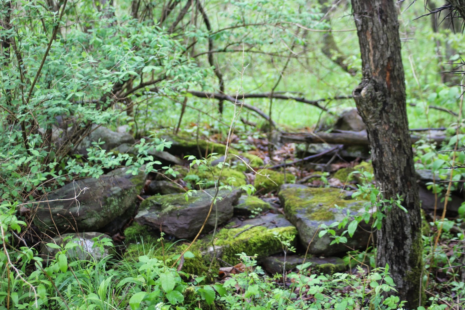
I did see this odd formation next to the grading. The rocks are placed to form a filled in circle.
I found this German cemetery in Tioga County. Many are the fisrt settlers of the area, Rexford and Furman are a couple infamous names. We almost boondocked here but didn't feel "safe from the boys".
 It is now 4pm, time to eat and relax. We have driven to the Allegheny Moutains and across the street a bit from the Susquehannock State Forest is Potter County Family Campground. Everyone is friendly. For a large campground it is pretty empty until Memorial Day. Again no price breaks, $20 a night, basic tent site, only 4 available, we was alone. Lucky if we was there 30 minutes before I had a battle with the ice chest.
The handle breaks off of it and I flew backwards. Off to the hospital we go.
The ice chest won, fractured above the wrist. My left hand and wrist badly bruised. We got back 5 hours later, now 10pm, and glamped it. Good thing because a very hungry black bear came through the site. I wouldn't have thought of having my machete. I was hungry, tired and in pain. Temps dropped to 33F. And it is suppose to rain for 4 more days. Campground owner felt horrible when I got back from the hospital and wanted to upgrade us to a heated cabin with a bathroom. All I wished for was a comped night to think over my plans but that wasn't going to happen. What is it with these campground owners? I have never seen anything like it. The tap water is very brown, makes your hair feel icky. Clogged shower.

So, after turning around again and again, wondering if I should jump on highway and travel quickly for 6 days to Washington or head back to Massachusetts I decided to head back, 11 hour drive. Ends up everything the Massachusetts doctor did I could have done. We will not leave again until the trailer is ready and the hitch is on the car so if I need to boondock I can. I had no phone or internet service so I couldn't ask for anyone's opinion.
It was an expensive but fun trip. These miles are close to the Ohio boarder.
Fall Foliage Laptop Skin For Mac and PC 
http://www.zazzle.com/fall_foliage_laptop_skin_for_mac_and_pc-134102582812863379 
 
How to preserve wood slices. 


Tuesday, May 20, 2014

Mahican - Mohawk Hike Trail - Erving, Massachusetts - Hiking, Mountain Climbing, Snowshoeing

I am so behind. My phone seldom had connection and only very basic WiFi, if I could find it while traveling through the mountains of Massachusetts, New York and Pennsylvania. Kaiya and I started on our hopeful 9,000 mile journey from Massachusetts to Washington.

First stop, Devens Prison Medical Hospital. Not that I planned it this way but I had a coffee pee that was screaming to be released. Exit sign stated public facilities but I couldn't find such a structure so figured it meant go where you don't think you will be caught. Now mind you that my eyes were floating so I missed some major signs such as this one...
Devens Federal Prison Medical Center

I parked only feet away and peed at a sign I did not see at the driver's door stated:
Federal Property
No Parking

Well, no one bothered us but I'm sure they have Kaiya and myself urinating on their property, oops.

Next stop, Erving, Massachusetts, a lovely quaint town. We wouldn't mind going back and spend a weekend. You can fish or whitewater kayak Millers River or go to Rattlesnake Mountain to hike or rock climb. There is a bit of history in this town of 1800 people.
Millers River
Kaiya had a lot of fun and wasn't ready to leave either but we just got on the road and wanted to get more miles behind us.

Next stop, Mahican - Mohawk Trail
Route 2 - Shelburne, Massachusetts
It is stated that this is a long hiking trail but it is still under construction as you can see here:
http://www.franklinlandtrust.org/M&M_Trail_Map.pdf
As soon as you enter it is very fragrant and plush. Be aware of the ticks.
You hike along Deerfield River. On the other side of the river there is a trail near the railroad. The train pulls at least 100 cars, amazing. Kaiya loves the sound of a train, tha-dump, tha-dump, tha-dump.
When you walk through the field go slow and you will see many bird species.
About 3/4 mile in the easy hike ends and a warning sign is posted, Rugged - Pass At Your Own Risk!
Here you will be hiking through private property. Some of the trail is only a foot wide with up to and over a 50 foot drop into the cold swift river. It was very wet, lots of creeks, very muddy and rocky. We suggest waterproof boots and gaitors for people and thick towel and baby wipes for your buddy to clean up aft the hike. This was Kaiya's toughest hike. She did go down a 3 foot drop and later on, into the river near an embankment. I had to keep her on lead for our safety.
The entire trail is well marked.
What a sight to see and hear. I wouldn't mind setting up camp here.
Then, sadly, you come to this about 1 1/2 miles in. In 2009 a property owner with a horse lives in this area. You may see horse prints on the trail. This isn't a loop trail so you just have to turn around. More information here:
http://www.deerfieldriver.org/pdf/M-M_%20Descrip_10-09.pdf
 
We sure enjoyed it and sat along the river for a bit. There are some sections where you are close to the road so you get that noise and they are repairing the power house. I wish I read more before stopping as the trail is much longer in other areas.
Indian Sarus Crane and Scarlet Ibis Bird Mug Porcelain MugSeveral sizes and styles to choose from. Double sided photo to make this a great mug for lefties also.

 http://www.zazzle.com/indian_sarus_crane_and_scarlet_ibis_bird_mug_specialty_mug-183015418038510085

Frisbee Golf Game...Fun game for the whole family.

You can also hang the basket on trees, Google for instructions, I enjoy Frisbee Golf!

I found this on mycomputerismycanvas.blogspot.com


Wednesday, May 7, 2014

Cape Cod Canal History - Massachusetts - Railroad Bridge - DIY Bird Feeder

I can not believe it is Wednesday already, wow. We have a super busy day. I need to care for my granddaughter for a few days while her father has heart surgery and Kaiya, who will be one next month, is going to teach their one year old Greater Swiss Mountain Dog some manners. While there I have to plug up the propane line on the camper that went to the heater, which is now fixed and ready for install but the tech wishes to install, ho-hum, as he also wishes to re-plumb the broken water lines, grrrr. So for the next two days I can check out some other things. Does the air conditioner work with propane? Does anything work with household currant? I need to wire in a kitchen light. I need to follow the wires and see if one broke for the running lights since they are not working and I saw wires wrapped around an axle. And I have to look at my rotted doorway where the step fell off last week and see if I can give that a quick fix until I reach destination. 

Yesterday Kaiya and I went for a 3 mile walk around the neighborhood. The weather was lovely, sunny and warm'ish. We zipped at 2-3 miles per hour, great pace. I was able to wear a tank top with a light weight jacket zipped up part way. I noticed her back nails are worn down too much. I'm going to have to break into my wallet and spend the $80 for Ruff Boots until she grows some length back, almost to the skin. She walked 15 miles in 3 days and that is just our travels. Then I took her home and went to a near by restaurant and had a veggie lasagna, it was oh so good, a new item on their menu. It had onion, green pepper and broccoli and they do top it off with pizza cheese, which I love especially their cheese.

On Sunday early noon we went to Cape Cod Canal and brought a friend with us. He was tuckered after a mile so we had to turn around. It was sunny, very breezy, warm'ish when we got there but when we hit the one mile mark it was very dark and the sky was going to break at any time and I didn't have the waterproof bag for my camera so just as well I guess. The rain did start within minutes of getting into the van.
 This may be a Bufflehead Duck, still looking into it. See how rapid the canal is flowing today? Not only was it windy but it just reached high tide. I see the moon is just reaching into it's seventh day to become a full moon so the very strong currant wasn't due to the moon. No one could fish on this day.
Here is the Severn Tugboat from Baltimore, Maryland, it pulling a barge through the canal. Notice the pretty blue sky? And you can still see the very strong currant.
Here we are with the Double Skin 59 Fuel Barge from Baltimore, Maryland. It just unloaded it's product and now heading out.
Here is the Sabine Tugboat from Texas that is following the barge and tugboat through the canal. They always need another tugboat just in case they run into trouble.
 
These were the only boats we saw today. Sunday's are usually slow. I don't know why since when you work on the water there are no weekends and seldom are there holidays. The pleasure crafts must have stayed close to where they dock due to the strong currant. The boats use the canal because the seas are a lot more dangerous if they went around Cape Cod and it also saves them a lot of time, hours, by cutting through the base of the Cape. So Cape Cod is now a man-made island but on Codders, people who live on the Cape, consider it an island.
This abutment is all that now remains of the original Bourne Bridge. Construction started in 1910 and was completed the following year. The canal was built by August Belmont's private company who began construction in 1909 and completed it in 1914. Monument and Scusset Rivers were connected to form the canal. The bridge also had rail tracks for trolly trains to bring passengers to New Bedford and Monument Beach in Bourne. The mural was painted in 2009 by Joshua Harrington, Scott Packard, Jr. and some other volunteers to show how the bride use to look, which was a drawbridge, also called a lift bridge, meaning each side of the road lifted upwards so the boats could pass through. The bridge was torn down in 1935 when two newer, longer and wider brides were completed while the canal was deepened and widened for large boats which began in 1930 and completed in 1935. Many Tall Ships can pass through although most do have to take down some of their tallest masts.
This is what the bridge use to look like. There is the trolly train on the lower left.
This is the 4 lane Bourne Bridge today, one of two bridges to bring you to the Cape. Traffic can be backed up for an hour to pass over either bridge during tourist season which is from June to September with weekends and holidays being the worst.
The belly of the bridge. Look at that sky! Yep, it got mean looking.
These are Cormorants, also called Shags in other parts of the world but these do not have a crest on their chest. They love fish and it is amazing how long they can stay under water. They will have the currant take them along until they find food and they will pop back up to eat. If the currant is too strong, like on this day, they will fly instead of swim to where they want to go next. They will nest in the rocks that line the canal or in trees.
We are finally starting to see color. Mother Nature is amazing.
Cape Cod Canal Railroad Bridge. Commuter rail from Boston now goes over this bridge to drop off passengers here and on the Cape in Hyannis. It is also used to carry the Cape's garbage off the island.

Well my friend is exhausted. Kaiya and I had another 4-6 miles left in us but we was content with 2 after doing 10 the day before. I didn't need a wet camera and Kaiya met so many wonderful people and dogs. She really had a great day.

We sure hoped you enjoyed today's blog. We had fun sharing but we must start packing now. So much to do and Kaiya loves to be underfoot.
 
Cape Cod Canal Train Bridge Customize Serving Tray
http://www.zazzle.com/cape_cod_canal_train_bridge_customize_serving_tray-256587082933675912

Here is a Do It Yourself Bird Feeder
Glue a plate onto the bottom. Google on how to drill a hole into the glass. And if you are trying to attach a certain type of bird make sure the hole is big enough for the large seed to fall out or tiny hole for the smaller seed. You can find a charm at any craft shop.